


Drones have rapidly advanced into a critical component of digital infrastructure management.
The evolution of drones in Indian construction and mining projects has been nothing short of transformative. Drones have rapidly advanced into a critical component of digital infrastructure management.

How do you look at the evolution of drones and their applications in Indian construction and mining projects?
The evolution of drones in Indian construction and mining projects has been nothing short of transformative. Drones have rapidly advanced into a critical component of digital infrastructure management. In the early stages, drones were primarily used for visual documentation and basic site inspections. However, with advancements in hardware, sensors like LiDAR and high-resolution RGB cameras, and the introduction of automated flight planning tools, drones quickly became powerful assets for topographic surveys, volumetric analysis, and real-time progress monitoring. Today, drones are deeply integrated into workflows, delivering accurate 3D models, orthomosaics, and digital surface models that aid in everything from project planning to execution. This shift is driven by the growing need for speed, precision, and safety in large-scale infrastructure and mining projects across India. Government initiatives such as the Digital Sky platform and clearer DGCA regulations have further encouraged adoption, while the decreasing cost of both hardware and cloud-based photogrammetry software has made drone technology accessible to even medium-sized enterprises. As a result, drones have evolved from being auxiliary tools to becoming indispensable in ensuring project efficiency, safety, and cost-effectiveness.
What are the major advantages of using drones at construction and mining projects?
Speed and efficiency - Drones can cover large areas in a fraction of the time compared to traditional survey methods. Drones can survey large areas quickly, providing accurate 2D and 3D models, reducing the time needed for site inspections, progress monitoring and providing real-time data on site conditions, leading to better resource management.
Accurate data collection - Equipped with high-resolution RGB, LiDAR, or multispectral sensors, drones can capture centimetre-level accuracy for:
• Topographic mapping
• Contour generation
• Volume and cut/fill calculations
Improved safety - Drones eliminate the need for workers to access dangerous zones in both industries. In construction, they inspect high-rise structures, unstable scaffolding, and confined spaces. In mining, they assess unstable slopes, blast sites, and deep excavation areas, minimizing human exposure to hazards like collapses or toxic gases.
Cost & time savings - Both construction and mining benefit from reduced labor and equipment costs. Drones conduct surveys and inspections faster than traditional methods, avoiding costly downtime. In construction, they track progress without halting work, while in mining, they optimize haulage routes and reduce fuel consumption by improving terrain analysis.
Progress monitoring and reporting- Drones provide frequent aerial updates, helping construction teams track building progress, detect deviations, and ensure adherence to schedules. In mining, they monitor extraction rates, dump sites, and rehabilitation efforts, allowing managers to make data-driven decisions quickly.
What are the current application trends of drones in Indian projects?
In 2024, India has witnessed a significant surge in drone applications across construction and mining sectors, driven by technological advancements, supportive government policies, and increasing demand for efficiency and safety.
Government push & regulatory support: India’s Drone Rules 2021 and Digital Sky platform have created a more favourable environment. Initiatives like Drone Shakti and PLI schemes aim to promote indigenous manufacturing and services. DGCA mandates drone surveys for mining projects and highway construction, pushing institutional adoption.
Urban expansion: With favourable regulations, drone usage in urban environments is expected to rise, aiding in areas like urban planning and infrastructure development.
Infrastructure surveillance: Organizations like the National Highways Authority of India (NHAI) employ drones to monitor highway construction, ensuring projects adhere to timelines and quality standards.
Mandatory drone surveys: The Department of Mines and Geology (DMG) of Rajasthan is leading the way in drone adoption by implementing forward-thinking policies aimed at transforming land management and mineral exploration. With these initiatives, the region has seen a surge in drone-based survey adoption, showcasing the state’s commitment to technological advancement. Also, other states are stepping to mandate the drone surveys for better clarity and supervision. Indian Bureau of Mines (IBM) have already mandated the drone surveys.
What are your key products and solutions for construction and mining projects?
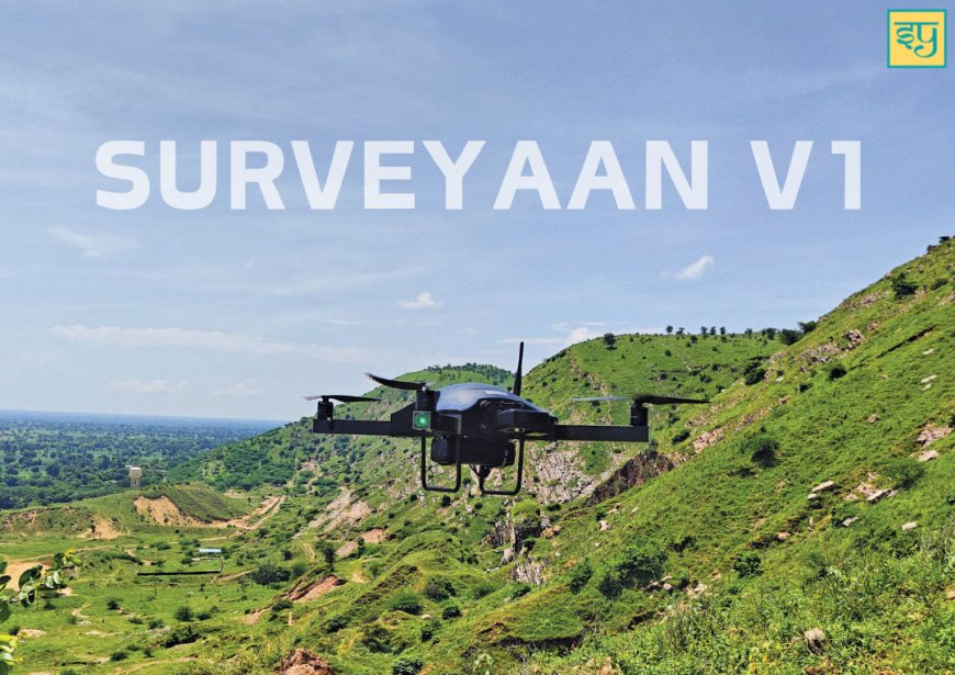
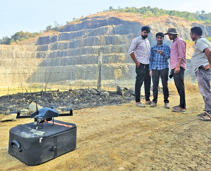
We, at Surveyaan, offer a comprehensive suite of drone-based solutions tailored specifically for the construction and mining industries. Our flagship surveying drone, Surveyaan V1, is designed for high-accuracy aerial mapping, equipped with a 23MP camera and robust flight stability to deliver centimeter-level precision—even in challenging terrain. The drones developed by Surveyaan are type certified as per DGCA and regulations, ensuring reliable operations and accurate collection of data within a much shorter time compared to the traditional method.
We also provide GeoWorkspace, our cloud photogrammetry software.
By leveraging AI and machine learning algorithms, GeoWorkspace processes large datasets collected by drones, converting them into detailed 3D models, contour maps, and digital terrain models. This capability allows us to obtain precise measurements for landforms, structures, and resources, enhancing the overall accuracy of our projects.
One of the key advantages of GeoWorkspace is its automated processing feature. Incorporating AI enables the platform to automatically perform data processing workflows, significantly reducing the time required to transform raw drone data into actionable information. This automation minimises human intervention and accelerates operations, ultimately leading to improved project efficiency. GeoWorkspace also includes smart anomaly detection capabilities. By analysing changes over time—such as shifts in stockpile volumes, erosion, or unauthorised encroachments—this feature provides stakeholders with real-time insights, empowering them to make quicker and more informed decisions.
For ground-level control, we offer a best-in-class DGNSS, SurveyPod V1, built to withstand rugged environments and ensure accurate geo-referencing. SurveyPod provides multi-constellation support by seamlessly integrating GPS, GLONASS, Galileo, and BeiDou Systems for enhanced reliability and accuracy for a better satellite visibility and performance in challenging environments. It can track up to 92 satellites and ensures exceptional accuracy by leveraging signals from multiple GNSS systems. One of the standouts features of SurveyPod is its tilt compensation technology, which allows users to capture accurate GNSS data even when the pole is tilted—eliminating the need to level the receiver manually. This greatly increases efficiency in the field, especially in difficult terrain or when accessing tight or obstructed spaces.
Together, our hardware and software ecosystem enables end-to-end solutions—from data capture and processing to actionable insights—empowering construction and mining teams to make faster, safer, and more cost-effective decisions.
What are the steps needed to promote the use of drones at construction and mining?
Educate and create awareness: Conduct workshops, seminars, and demo days at construction sites, mining zones, and industry expos publishing detailed case studies will help build confidence in drone technology among traditional industry players.
Train and upskill the workforce: Creating a skilled workforce is crucial for sustainable adoption. This involves establishing certified training programs through partnerships with institutes to produce qualified drone pilots. Beyond flight operations, engineers need training in specialized data processing tools to derive maximum value from drone-captured data. Integration of drone training into government skilling initiatives would ensure wider accessibility and standardization of skills across the workforce.
Technology integration: For maximum impact, drone technology must seamlessly integrate with existing systems. Ensuring compatibility with BIM platforms, GIS systems and AutoCAD will make drone data more actionable. Advanced applications like AI-powered analytics can transform raw data into real-time operational insights (e.g., automated stockpile volume calculations).
Industry collaboration: To accelerate the adoption of drones in India's construction and mining sectors, strategic industry collaboration is essential. Leading government entities should mandate drone-based monitoring in tenders for critical applications such as stockpile audits, progress tracking, and environmental compliance solutions.
Government advocacy: Policy leadership can drive rapid adoption. Making drone-based monitoring mandatory for EIA compliance in mining would create immediate demand. Aligning drone data collection with national initiatives would demonstrate how drone technology supports larger infrastructure development goals while creating standardized datasets for planning and monitoring purposes.
What are your future plans in the development of drone industry?
The drone industry is rapidly evolving to transform construction and mining operations through technological innovation and regulatory advancements. Looking ahead, we foresee several key developments that will shape the future of industrial drone applications.
Artificial intelligence and autonomous operations will become central to drone capabilities. Future systems will feature fully automated drones with advanced AI-powered obstacle avoidance for real-time site monitoring. These intelligent drones will incorporate predictive analytics to forecast potential equipment failures, slope instability risks, and project delays before they occur.
The integration of advanced sensors and payloads will dramatically enhance drone functionality. Future drones will utilize hyper-spectral and thermal imaging to detect mineral deposits, structural defects, and heat leaks with unprecedented accuracy. Specialized safety drones equipped with gas and radiation detection capabilities will become essential in hazardous mining environments. The combination of 5G connectivity and edge computing will enable instant data processing for live site monitoring. We may see delivery drones in action for some of the work in India shortly.
